By Chase Straw and Jack MacKenzie
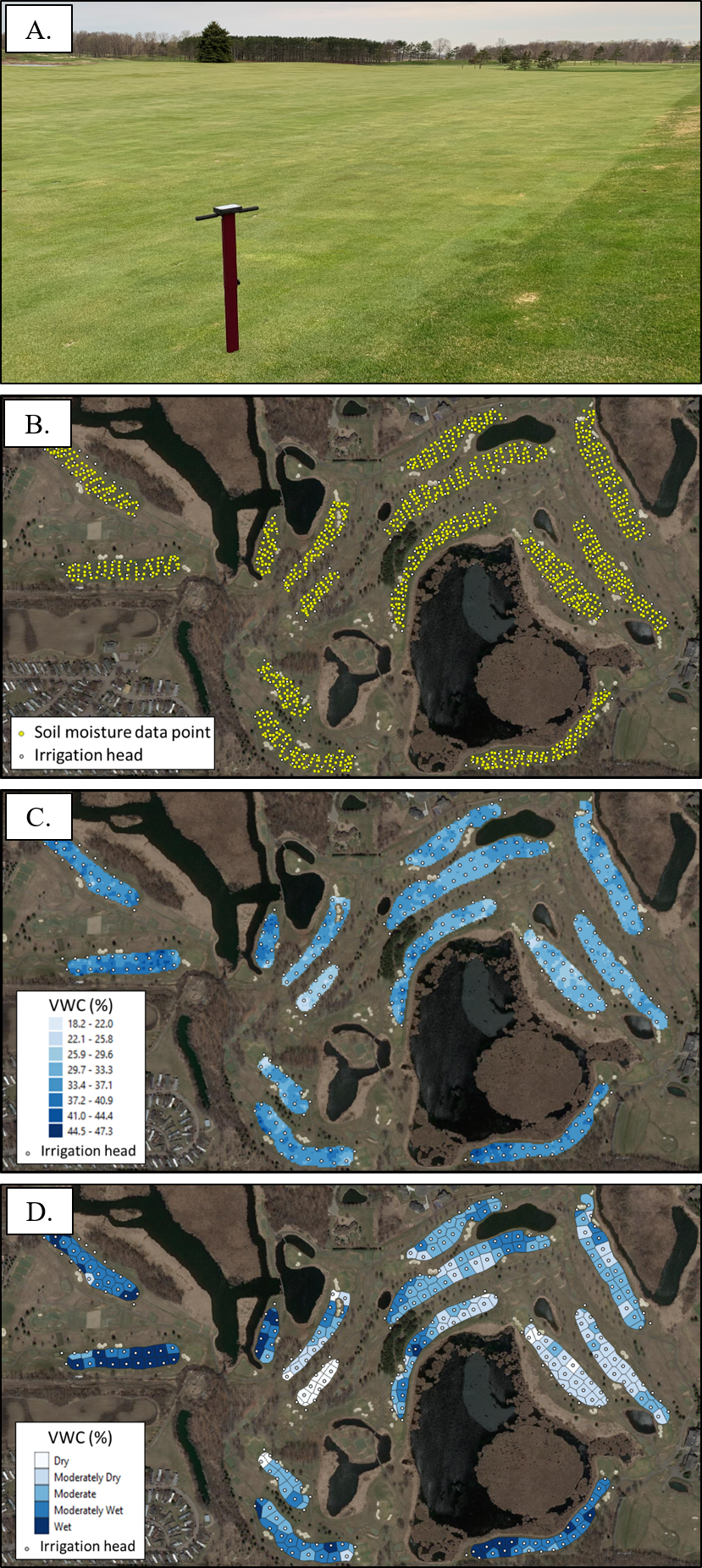
Golf course superintendents often irrigate fairways based on feel. Despite sometimes adjusting percent run-times of individual heads to account for perceived dry and wet areas, “blanket” applications are typical. Using objective data to create soil moisture maps of a golf course’s fairways, as well as taking advantage of valve-in-head control (if applicable), could significantly reduce water consumption by programming an irrigation system to match soil moisture variability. This would involve assigning each irrigation head to a soil moisture class, as a result of their surrounding soil moisture values, and then creating a program for each class to irrigate together. “Dry” classes would get irrigated more frequently, “wet” classes would get irrigated less frequently, and an entire fairway would almost never get completely irrigated during one irrigation session. This process fits under the concept of “site-specific irrigation” or “precision irrigation.”
In an effort to entice the utilization of soil moisture maps for improved irrigation decisions, and to allow for hands-on experience with mapping technologies, the University of Minnesota and the Minnesota Golf Course Superintendents Association (MGCSA) have collaborated to create a practical strategy for golf courses to map fairway soil moisture themselves. The University has prepared a detailed protocol that outlines step-by-step instructions to collect georeferenced soil moisture data with a GPS-equipped soil moisture meter (FieldScout TDR 350), which can then be used to create fairway soil moisture maps and irrigation management zones with free mapping software (Figure 1). The protocol is estimated to take one person 2 to 3 days to complete an entire 18-hole golf course. Superintendents, staff members, interns, local high school golfers, etc. would all be capable of completing the protocol.
Additionally, MGCSA is establishing an incentive program for members who complete the soil moisture mapping protocol. The program would give a person a $125 Visa gift card per nine holes completed (i.e. when final maps and irrigation management zones have been created). A system is also being put in place where those who do not have access to a GPS-equipped soil moisture meter can borrow a MGCSA- or fellow member-owned device. MGCSA anticipates positive outcomes from this initiative, such as water conservation, legislative appreciation, state agency acknowledgement with potential long-term impact on water priorities, and added membership value.
The protocol is available to everyone and is applicable at any golf course. It can be downloaded for free HERE.
Thank you to the Minnesota Golf Course Superintendents Association for their support developing the soil moisture mapping protocol.
Chase Straw ([email protected]) is a Postdoctoral Research Associate at the University of Minnesota. Jack MacKenzie ([email protected]) is the Executive Director of the Minnesota Golf Course Superintendents Association.
